goodwoodglobes
9″ × 12″ Mountain Maps
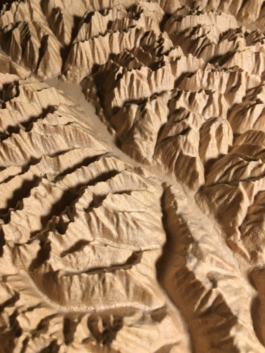
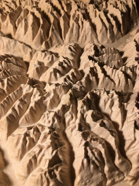
Beautiful, tactile, wood-carved maps
Choose any mountainous area within the US or Canada
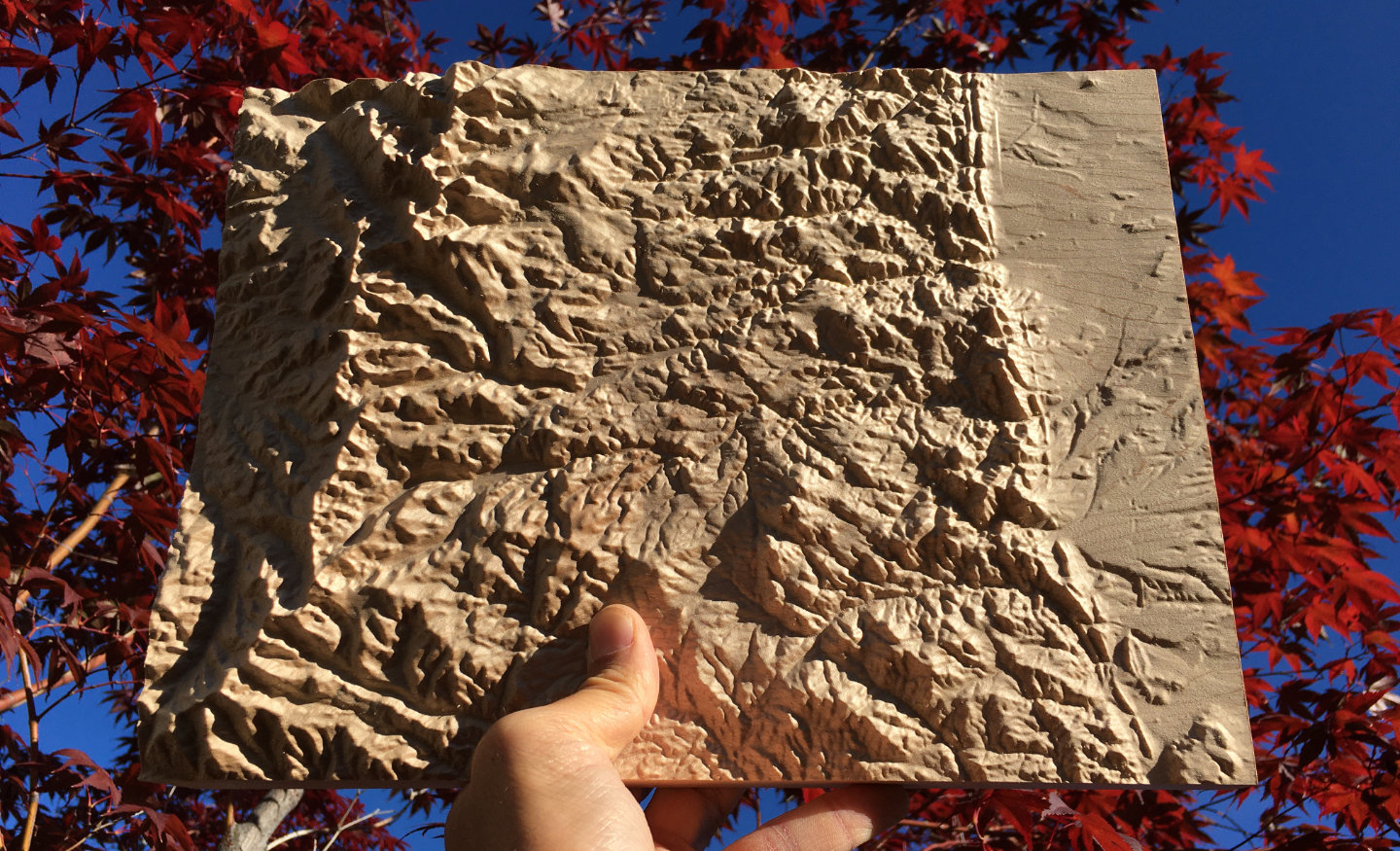
Precision machine-carved from fine North American maple wood
Painstakingly hand-finished with museum-grade microcrystalline wax
Made in the Kootenays, British Columbia, Canada
9″ × 12″ mountain map in maple
Choose any mountainous area within the US or Canada
Custom inscription on the back
$360
Canadian dollars
Free shipping to US & Canada
What people are saying
“Thank you so much! The map is beautiful. A work of art.”
– Amanda Hoffus, Rossland, BC
“I’ve just received the map -- it’s absolutely amazing, a legitimate treasure. It’s so cool to experience these mountains in a new medium; there are structures and continuities in the landscape that I hadn’t been able to perceive on ordinary maps (or by hiking there for many years).”
– Ben Radcliffe, South Pasadena, CA
“I’m back from the field and had this wonderful shipment waiting in my office. I’ve just thrilled with the results. They look great and are a work of art for sure. Thank you so much.”
– Dick Mynen, Prince George, BC
“Actually holding it in person is beyond breathtaking. The three dimensions, the bridges, the tiny shadows of the ridges cast in light....all amazing. Thank you so so very much.
I’m blown away. I can’t wait till my kids can see and understand this as well as how you made it.
Perfect!!!”
– Ryan Cohen, Pittsburgh, PA
Canada 9″ × 12″ Mountain Maps
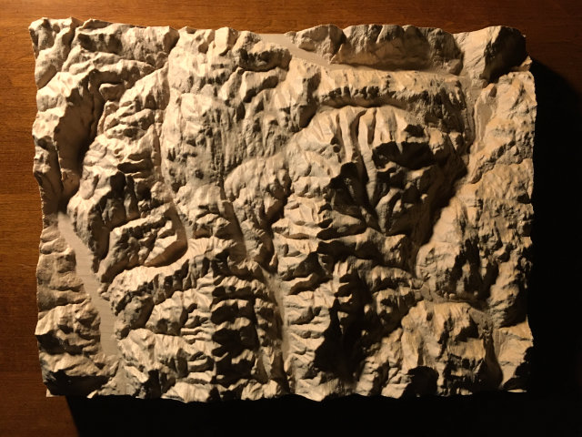
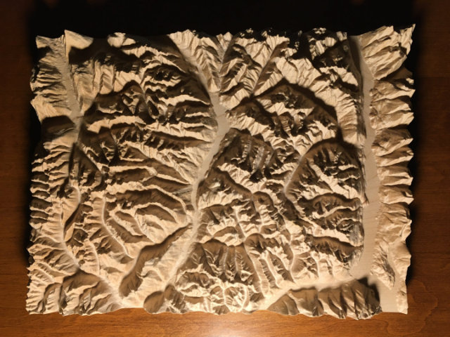
Rossland Range
The mountains of the Rossland Range in the Kootenays, British Columbia, Canada, including Red Mountain, Grey Mountain and Granite Mountain, all part of the Red Mountain ski resort, as well as Old Glory Mountain, Nancy Greene Lake, Big Sheep Creek, the Columbia River and the cities of Rossland and Trail
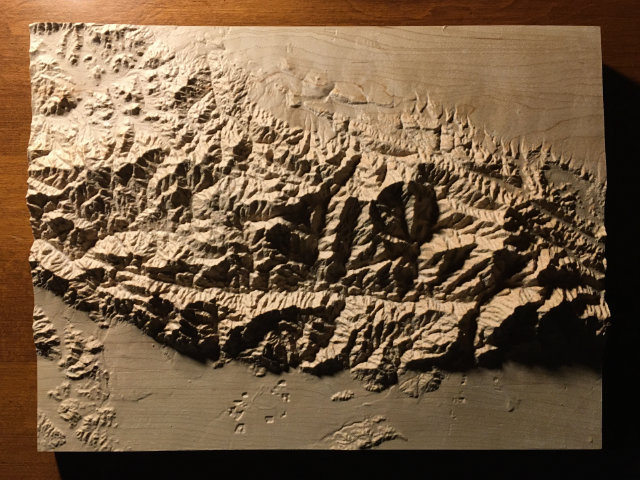
Valhalla – Kokanee
The mountains of Valhalla & Kokanee Glacier, British Columbia, Canada, with Valhalla Provincial Park on the left, the Slocan Valley running north-south down the middle, and Kokanee Glacier Provincial Park on the right, including Upper Arrow Lake, Gimli Peak, Gwillim Lakes, Slocan Lake, Idaho Peak, Kokanee Glacier Cabin, Kaslo Lake, Kootenay Lake and the towns of Winlaw, Slocan, New Denver, Kaslo, Ainsworth and Crawford Bay
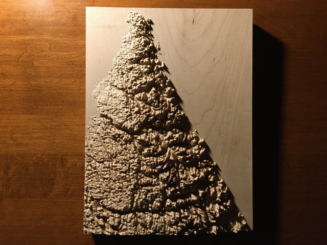
Torngat Mountains
The Torngat Mountains, straddling Newfoundland & Labrador, Quebec and Nunavut, Canada, showing the Atlantic coastline from the Torngat base camp and Saglek airstrip on Saglek Fiord, up to Cape Chidley on Killiniq Island, including the entire area of the Torngat Mountains National Park
Don’t see the area of Canada you’re interested in?
US 9″ × 12″ Mountain Maps
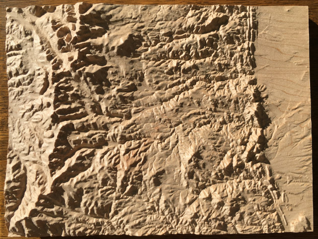
San Gabriel Mountains
The San Gabriel Mountains in Los Angeles County and San Bernardino County, California, United States, including Mount Wilson, Mount Islip, the Mount Baldy (Mount San Antonio) ski area, Baldy Bowl, Mount Harwood, Telegraph Peak, Cucamonga Peak, Ontario Peak, the Devils Backbone, the Bridge to Nowhere, the Angeles Crest Highway and the City of Pasedena
Don’t see the area of the US you’re interested in?
Want one of your own?
9″ × 12″ mountain map in maple
Choose any mountainous area within the US or Canada
Custom inscription on the back
$360
Canadian dollars
Free shipping to US & Canada
 Twitter
 Instagram