goodwoodglobes
Torngat Mountains
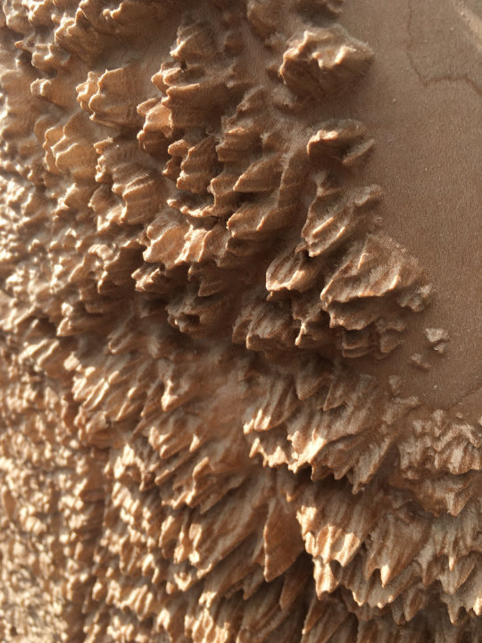
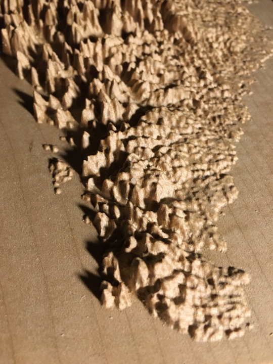
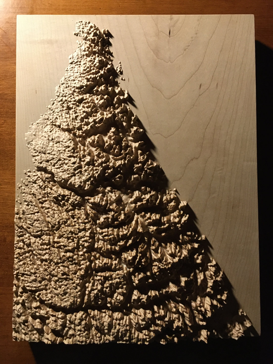
9″ × 12″ Mountain Map
A beautiful, tactile, wood-carved map of the Torngat Mountains
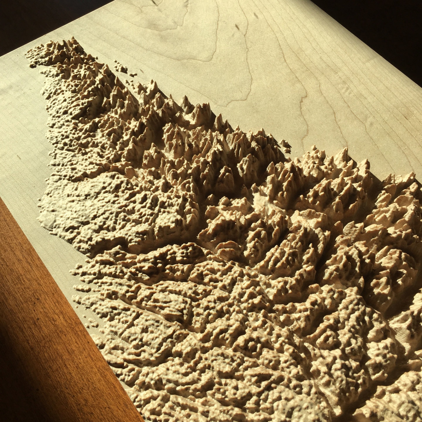
The Torngat Mountains, straddling Newfoundland & Labrador, Quebec and Nunavut, Canada, showing the Atlantic coastline from the Torngat base camp and Saglek airstrip on Saglek Fiord, up to Cape Chidley on Killiniq Island, including the entire area of the Torngat Mountains National Park
Precision machine-carved from fine North American maple wood
Painstakingly hand-finished with museum-grade microcrystalline wax
Made in the Kootenays, British Columbia, Canada
9″ × 12″ Torngat Mountains mountain map in maple
Custom inscription on the back
$360
Canadian dollars
Free shipping to US & Canada
What people are saying
“Thank you so much! The map is beautiful. A work of art.”
– Amanda Hoffus, Rossland, BC
“I’ve just received the map -- it’s absolutely amazing, a legitimate treasure. It’s so cool to experience these mountains in a new medium; there are structures and continuities in the landscape that I hadn’t been able to perceive on ordinary maps (or by hiking there for many years).”
– Ben Radcliffe, South Pasadena, CA
“I’m back from the field and had this wonderful shipment waiting in my office. I’ve just thrilled with the results. They look great and are a work of art for sure. Thank you so much.”
– Dick Mynen, Prince George, BC
“Actually holding it in person is beyond breathtaking. The three dimensions, the bridges, the tiny shadows of the ridges cast in light....all amazing. Thank you so so very much.
I’m blown away. I can’t wait till my kids can see and understand this as well as how you made it.
Perfect!!!”
– Ryan Cohen, Pittsburgh, PA
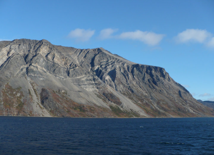
The Torngat Mountains at the tip of the Labrador Peninsula form an extraordinary rocky landscape fragmented by deep fjords. Accessible to humans only by sea and by air, the mountains are home to caribou and polar bears. Torngat is derived from an Inuktitut word meaning place of spirits.
Want one of your own?
9″ × 12″ Torngat Mountains mountain map in maple
Custom inscription on the back
$360
Canadian dollars
Free shipping to US & Canada
 Twitter
 Instagram