goodwoodglobes
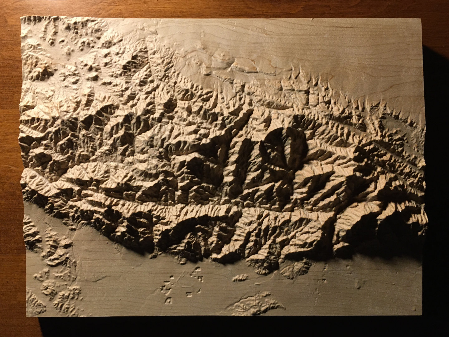
San Gabriel Mountains
9″ × 12″ Mountain Map
A beautiful, tactile, wood-carved map of the San Gabriel Mountains in California
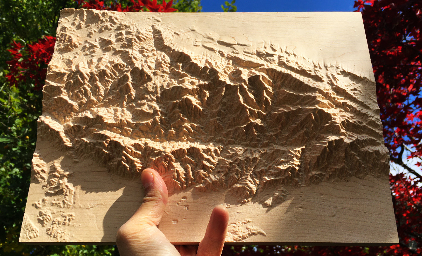
The San Gabriel Mountains in Los Angeles County and San Bernardino County, California, United States, including Mount Wilson, Mount Islip, the Mount Baldy (Mount San Antonio) ski area, Baldy Bowl, Mount Harwood, Telegraph Peak, Cucamonga Peak, Ontario Peak, the Devils Backbone, the Bridge to Nowhere, the Angeles Crest Highway and the City of Pasedena
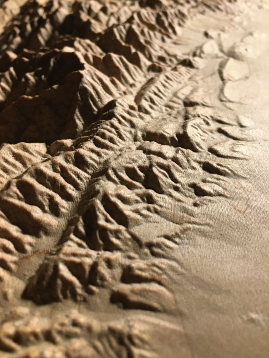
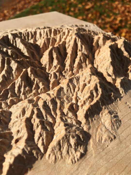
Precision machine-carved from fine North American maple wood
Painstakingly hand-finished with museum-grade microcrystalline wax
Made in the Kootenays, British Columbia, Canada
9″ × 12″ San Gabriel Mountains mountain map in maple
Custom inscription on the back
$360
Canadian dollars
Free shipping to US & Canada
What people are saying
“Thank you so much! The map is beautiful. A work of art.”
– Amanda Hoffus, Rossland, BC
“I’ve just received the map -- it’s absolutely amazing, a legitimate treasure. It’s so cool to experience these mountains in a new medium; there are structures and continuities in the landscape that I hadn’t been able to perceive on ordinary maps (or by hiking there for many years).”
– Ben Radcliffe, South Pasadena, CA
“I’m back from the field and had this wonderful shipment waiting in my office. I’ve just thrilled with the results. They look great and are a work of art for sure. Thank you so much.”
– Dick Mynen, Prince George, BC
“Actually holding it in person is beyond breathtaking. The three dimensions, the bridges, the tiny shadows of the ridges cast in light....all amazing. Thank you so so very much.
I’m blown away. I can’t wait till my kids can see and understand this as well as how you made it.
Perfect!!!”
– Ryan Cohen, Pittsburgh, PA
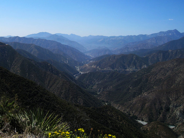
Visible from downtown Los Angeles, the San Gabriel National Monument is a rugged mountainous wilderness. Criss-crossed by faults, including the San Andreas Fault at its northern border, the area is still being formed by tectonic forces, raising mountains as high as Mount San Antonio, over 10,000 feet. The San Gabriel Mountains are home to the Mount Wilson Observatory, the Mount Baldy Resort and the Bridge to Nowhere.
Want one of your own?
9″ × 12″ San Gabriel Mountains mountain map in maple
Custom inscription on the back
$360
Canadian dollars
Free shipping to US & Canada
 Twitter
 Instagram