goodwoodglobes
Methow Valley
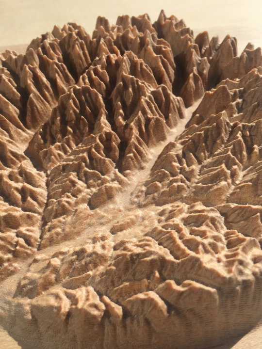
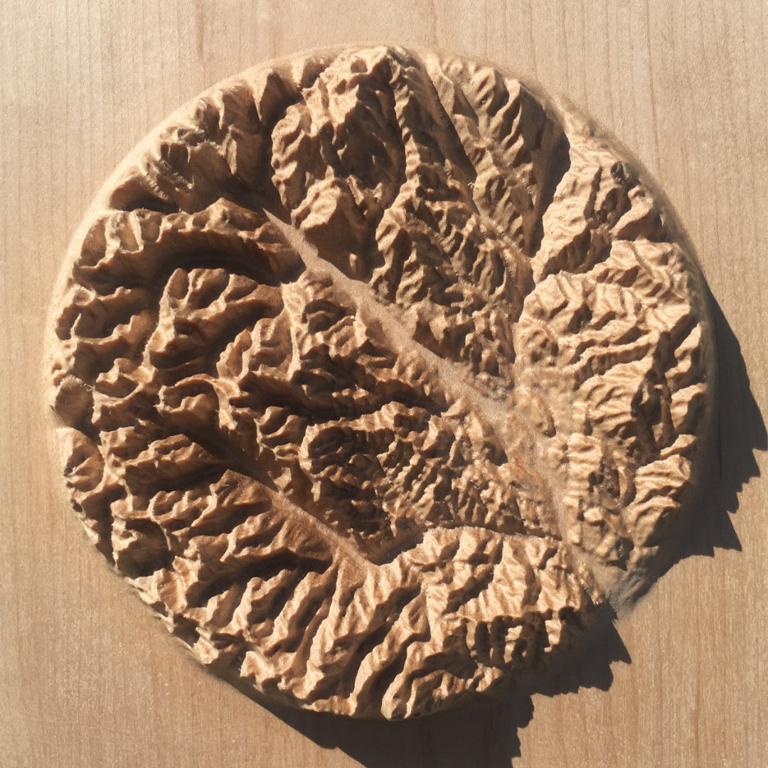
7″ Mountain Map
A beautiful, tactile, wood-carved map of the Methow Valley in the North Cascades
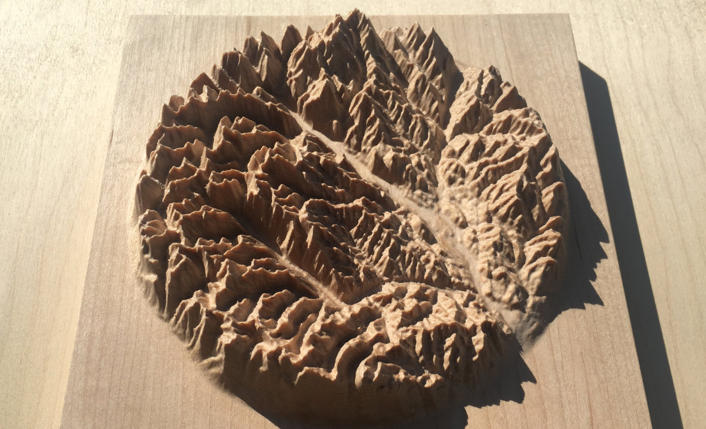
The mountains of the Methow Valley in the North Cascades, Washington, United States, including Goat Peak, Goat Wall, Flagg Mountain, Sandy Butte, Fawn Peak, Mount Gardner, The Needles, Early Winters Spires South, the Methow River and the towns of Winthrop and Twisp
Precision machine-carved from fine North American maple wood
Painstakingly hand-finished with museum-grade microcrystalline wax
Made in the Kootenays, British Columbia, Canada
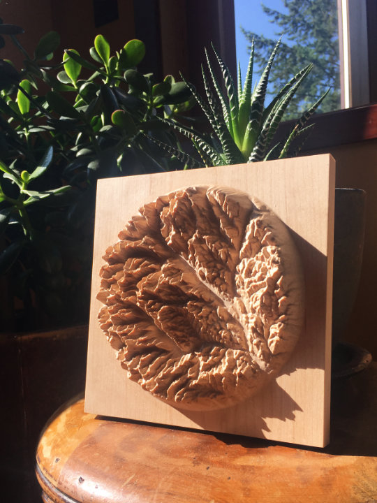
7″ × 7″ Methow Valley mountain map in maple
Custom inscription on the back
$240
Canadian dollars
Free shipping to US & Canada
What people are saying
“Thank you so much! The map is beautiful. A work of art.”
– Amanda Hoffus, Rossland, BC
“I’ve just received the map -- it’s absolutely amazing, a legitimate treasure. It’s so cool to experience these mountains in a new medium; there are structures and continuities in the landscape that I hadn’t been able to perceive on ordinary maps (or by hiking there for many years).”
– Ben Radcliffe, South Pasadena, CA
“I’m back from the field and had this wonderful shipment waiting in my office. I’ve just thrilled with the results. They look great and are a work of art for sure. Thank you so much.”
– Dick Mynen, Prince George, BC
“Actually holding it in person is beyond breathtaking. The three dimensions, the bridges, the tiny shadows of the ridges cast in light....all amazing. Thank you so so very much.
I’m blown away. I can’t wait till my kids can see and understand this as well as how you made it.
Perfect!!!”
– Ryan Cohen, Pittsburgh, PA
The Methow River carves a deep valley into the North Cascades in Washington State. Highway 20 follows the river through the towns of Winthrop and Twisp on the wide valley floor, before climbing steeply into the mountains. The peaks here are well known to the locals: Goat Peak, Goat Wall, Flagg Mountain, Sandy Butte, Fawn Peak, Mount Gardner, The Needles, Early Winters Spires South.
Want one of your own?
7″ × 7″ Methow Valley mountain map in maple
Custom inscription on the back
$240
Canadian dollars
Free shipping to US & Canada
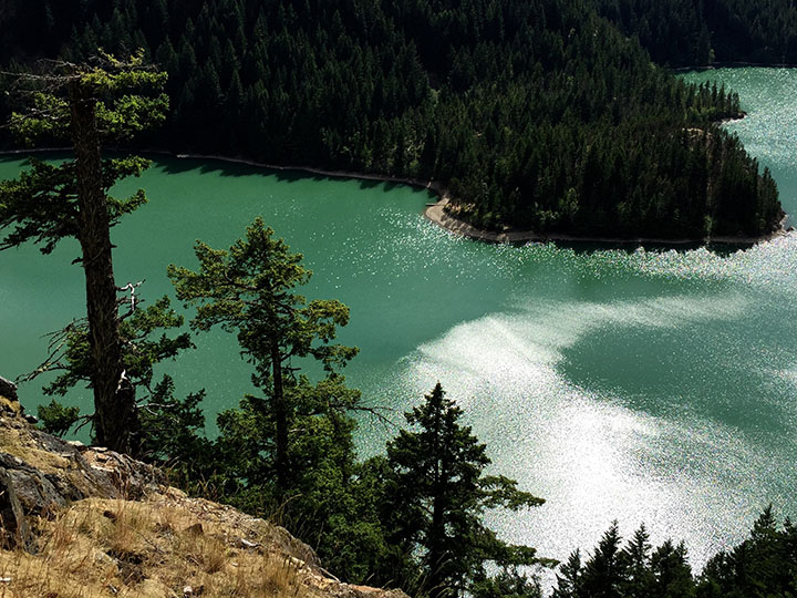
Image of Methow Trip June 16, 17, 18, 2015 (adapted) by Sandy Brown Jensen reproduced under CC BY 2.0
 Twitter
 Instagram